Tuesday, January 2, 2018

Senior backpacker goes to Scotland for hiking, challenging the Munros

The Munro & Mt. Cairngorm
  When I was climbing alone up toward the peak of Mt. Cairngorm (1245m) in Scotland on July 25 2017, I was following behind two middle aged women hikers with no other walkers seen on the mountain path. When they took a little bit longer rest at the site with a good view, I caught up with them and had a chat about small things like where each of us came from. I found that one of them was especially enthusiastic to be on the top of the mountains listed in the ‘Munroe’. But I was confused about her mention of “Munroe”, because there was no such a word in my dictionary at that time. 
    

 After returning to Japan, I found that the Munro represents the 277 mountains in Scotland that are least 3,000 feet (914m) high named after Sir. Hugh Thomas Munro (1856-1919), who published a list of all such mountains in the journal of the Scottish Mountaineering Club in 1891. 
 In Japan, we also have a similar bible for mountain hiking lovers that is called as “100 beautiful mountains in Japan" by Kyuya Fukada published in 1964. Before the age of 35, I had already completed nearly half of them. But after I had the right lung surgery due to the suspicious symptom of a cancer, I had given up the idea of climbing all 100 mountains in Japan. So I had empathy with this rather quite woman. 
 There was a mountain cable car connecting the bus stop at the foot with the restaurant on the mid-slope of a mountain. But if you got on this cable car, you would not be allowed to go outside at the restaurant and miss the chance to be on the peak.

Mt. Ben Nevis, the highest in UK
 The small country town of Fort William is called as the “Outdoor capital of the UK. Based here for 5 days, everyday I enjoyed an excursion for hiking. On the 1st Day, July 21 2017, I went to climb up Mt. Ben Nevis, the highest in the UK with the peak of 1345m high. In comparison with mountains in Japan, 1345m is not impressively high, but the climate here is drastically different from that in Japan due to the location. Fort William is located at the north latitude of 56.8 degree while the far most northern part of Japan at around the NL 45 degree. So the weather above the middle-slope was severely cold with a violent wind blowing to block my way. I several times thought back over the advice from a kind staff in the Fort William tourist office saying that if the trekking path invisible due to a heavy fog, you should return.


After the last several hours of struggling to advance under the severely strong and cold wind with sleeting rain hitting all my body, I have made it. Now I’m on the top of Mt. Ben Nevis, the highest in UK! There seemed to be no solo hiker there with the age of older than 67 years.


 I took a taxi from the town to the entry point into the mountain instead of using a bus which did not operate so early in the morning. I started to walk at around 7 am and returned here at 16 pm. After the total 9 hours walk, I enjoyed from the bottom of my heart the real Scottish Ale Beer at the Ben Nevis Inn which stood nearby the entry point.

Pap of Glencoe
  The Glencoe village is located less than 30km south from Fort William with the bus driving time of 30 minutes. The village was lying on a U-shaped glen of volcanic origins, formed by an ice age glacier and spread about 12.5 km long & 700 m wide. Glen Coe is said to be one of the most spectacular and beautiful glens in Scotland.

 In February 1692, an incident known as the Massacre of Glencoe took place here where thirty-eight men of the Clan MacDonald were killed by the sudden sneaky attack of the England king forces and another forty women and children later died of exposure after their homes were burned. This tragedy seems to be still rooted in the minds of people in the Highlands of Scotland and symbolize the historical conflicts between Scotland & England. The place is also famous for the Harry Potter film shooting location.

On the 2nd day in Fort William, July 23 two days after climbing to the peak of Mt. Ben Nevis, I went for an excursion to Glencoe village and attempted to walk up the nearby Mt. Pap of Glencoe. From the bus stop I had walked through the really picturesque village of Glencoe.
     

The ascent was only 716 m high, but the path was steep and so narrow and rough that I often found it difficult to recognize the right trek. As I walked up, I realized how the glen opens out to Loch Leven.


Compared to Mt. Ben Nevis, there were very few hikers on the path. When I lost my way, wondering which direction should I take, I met beautiful hikers from France.


They were students and said that they would be graduated from university in September. They were going to sleep on top of the hill, equipped with all camping tools including a portable tent. I recalled my younger days when I used to climb mountains in Japan carrying a heavy rucksack on my back together with my friends in the university. I was impressed by these charming hikers, so gentle and energetic.   

The Old Man of Storr on the Isle of Skye
 When I departed from Fort William using a Citylink bus on July 24 heading for the Isle of Skye, I was joined by my old friend who came from Italy where he was working. Based on the SYHA Broadford Hostel, we planned to make a drive tour to explore this bizarre Island. On the day after arriving, we together made one day car-tour in the northern part of the Isle, visiting the old man of storr.

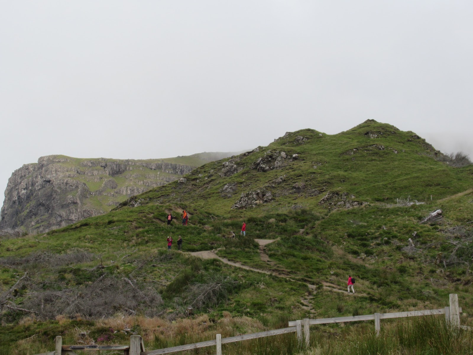


The Old Man of Storr is a large pinnacle of rock that stands high & created by a massive ancient landslide, leaving one of the most picturesque landscapes in the Isle. With that having been said, as usual in Scotland when we approached toward the hilltop, the sky became suddenly dark with the winds blowing violently in the dense foggy atmosphere. But we were happy to be here to be able to walk in the magnificient landscape. Back to the parking site, we started to explore the northern coastal area of the Island, which made us feel how severe life was in the winter season for those islanders in the old days.


Below is my itinerary in Scotland during July 18 to 31, 2017.


Friday, October 28, 2016

Autumn deepning in Mt.Hakkoda, Japan

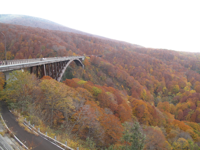
My wife is not so interested in traveling. But it's a different story when it comes to our grandson of three years old coming along together with us. And now is the best time for appreciating the beauty of Autumn leaves changing their colors in Oirase, the mountain stream flowing out of the lake Towada. So why not to make three days’ trip to the Towada-Hakkoda region of the Towada-Hachimantai National Park from 22nd to 24th Oct., 2016, together with our eldest son's family? The national park is situated in the far northern part of the main island of Japanese Archipelago and boasts of serene lakes, vast forest of colorful Japanese Beech and Betula ermanii, and live volcanoes, thus providing visitors with nice hiking treks and a lot of superb hot springs, Onsen, The below is a view from Jyougakura (城ヶ倉) on the way to Mt. Hakkoda from the lake Towada.
A view from Jyougakura (城ヶ倉) 

Since the Tohoku Shinkansen, the new bullet train line connecting Tokyo with Aomori 674 km (419 miles) distant opened in 2010, Tohok, the northern part of Japanese main island has become so easy to access for those living in the big metropolitan cities of Tokyo and its neghborhood. We got on the bullet train Hayabusa N o.3 at 7:42 am at JR Ueno station and reached to Hachinohe station at 10:31am, where our youngest son also joined us. He departed Tokyo last mid night on a long distance coach which is much cheaper than the bullet train although he is a very rich bachelor working in one of the top camera makers in Japan. On the way, the Hayabusa stopped at Morioka station for about 6 minutes  in order to disconnect another bullet train Komachi going for Akita. Vice versa, when Hayabusa goes back to Tokyo from Aomori, it connects Komachi coming from Akita at this station. Every Japanese kids love to see this train connecting & disconnecting. My elder son quickly carried our grandson on his back to the front carriage of Hayabusa to let him see this actually happening while the train was stopping at Morioka. We were happy to see him so excited.

Komachi disconnected from Hayabusa at Morioka 


 From Hachinohe station we were heading for Lake Towada on a rent-a-car.  This mysterious Lake is a caldera lake formed by the volcanic activities that began approximately 200,000 years ago, with the surface area of 61 km and the maximum depth of 327 meters. The lake is also well known for two decades efforts by Wainai Sadayuki to introduce princess trout (kokanee) into it, who had made it for the first time in 1903. Before that there was no fish in the lake. I was reminded of his great success which I learned in my elementary school days more than half a century ago. We got on the cruising boat at Yasumiya and enjoyed colorful Autumn leaves on the shore from the boat, which consist mainly of Erman’s birch and Siebold’s beech.
Lake Towada


After cruising, we drove up to Yachi Onsen, Yachi Hot Springs situated on the mountain's breast with the altitude of 782 meters above the sea level, where there was only one mountain Inn with hot spring that we were going to stay for two nights. It gives us a supreme happy feeling to take a bath in a hot spring and taste a dish prepared from edible wild plants and the lake's fish with Sake after a day's hiking. The mountain inn was quite and well harmonized with its surrounding natural environments.
Yachi Hot Springs (谷地温泉)
   

On the 2nd day, we went to Mt. Hakkoda for a small hiking with 3 year old grandson. Mt. Hakkoda actually refers to a mountain range with more than 10 peaks centered around the main highest peak of 1584 meters, Mt. Odake. We took a gondola of the aerial ropeway at the foot of Mt. Tamoyachidake which carried us to its summit station in about 10 minutes. It was severe cold with the temperature of minus 2 degrees and the trekking path muddy due to the melting snow of last night. So our eldest son was obliged to carry his son all the way on his back and we decided to take a short round trip of hiking trail. But the view was so magnificent that I realized Autumn deepening steadly in Mt. Hakkoda with leaves color changing from the peaks to the foots over the vast forests. Mt. Hakkoda is poised for winter coming. 
Mt. Hakkoda (八甲田山) 


As we ended up earlier with hiking around the summit station than our original plan, we looked for an alternative hiking trail which all of us would be able to enjoy hiking in a more comfortable way with the warmer temperature. So we decided to go to Tasirotai Marsh. This marsh is the largest in Mt. Hakkoda range and was originally the caldera lake formed by the volcanic activities of Mt. Hakkoda which ocurred 2 million years ago.  The caldera has turned gradually into a marsh over long period of time. The marsh is abundant in beautiful wild flowers which are spectacular especially during June to August, and provides a good hiking trail which starts from the small turquoise blue pond. Hikers can walk easily on a path paved with planks over the marsh. Our grandson had never asked his dad to carry him on his back and was excited to try to find his favorite insects on the way. The marsh was quite, sunny, and giving us the pleasure of family hiking.
Tasirotai Marsh (田代平湿原)


On the final day of our trip, we visited Oirase stream on the way back to Hachinohe JR station. Probably Oirase is the most popular tourist destination in the Towada-Hakkoda region, so the place is very crowded especially on Saturday and Sunday with visitors coming from various countries including China, South Korea, and other Asean countries. That's why we came here on Monday 24th Oct. when we returned to Tokyo,   

The Oirase stream runs through a mountain valley approximately 14 km long with its source in Lake Towada. With the clarity of the water, the incessantly changing flow over mossy rocks under forests of giant trees, and many waterfalls, those create the scenic beauty to its landscape. The path along the stream also parallels the car road on which public bus go periodically, so the visitors of any ages can start walking from anywhere in the course of 14 km distance in total and switch to getting on a bus if he or she feels tired in walking. We parked our rent-a-car at two points and enjoyed walking each for less than 45 minutes, so short time partly because it started to rain.     
Oirase mountain stream (奥入瀬)


Thursday, October 20, 2016

Trieste -Senior backpacker goes to Slovenia (9)

 Trieste is an Italian city bordered with Slovenia, and it has been a multicultural and disputed area among the three nations, Italy, Austria, and Slovenia. Most recently it was under control of Yugoslavia militant regime led by Titto just for 40 days at the end of WW2. It had been flourishing as an important Mediterranean seaport of the Austrian Habsburg Dynasty from 1382 until 1918 following WW1. 
 When I planned to visit Slovenia, I first examined the possible route to enter into it from Venice through Trieste as there is no direct flight connecting Japan with Slovenia. But finally I decided to drop in Trieste during the return trip to Japan. After hiking in the mountainous region of Kamnik and Bohinj, I thought it would be nice to see blue Mediterranean sea and that a train trip from Bohinj to Trieste would be also attractive. 


Train trip from Bohinj to Trieste
 On July 28 after enjoying 6 days’ hiking in Bohinj, I took a train early in the morning which departed Bohinjska Bistrica at 6:50 am for Sežana. The train ran through small and peaceful villages in the mountainous regions, stopping at every stations and crossing the bridge over the Soča River until reaching to Nova Gorica on the border with Italy, where I needed to wait for around one hour. The station was rather big, but a very quite with a few passengers occasionally seen walking on the platform like an old man accompanied by his dog or a bicyclist passing by while I was sitting on the bench.


Villa Opicina's tram car
 I got off the train at Sežana and tried to find a bus or taxi to go to Villa Opicina in Italian territory just located in the middle between Sežana and Trieste, but I spent more than one hour until catching a taxi, which carried me to the inn in Villa Opicina for less than 15 minutes. There was no boarder check on the entry into Italy, which made me realize the EU's freedom of movement of people. The place is located a little bit far from Trieste, but it is nice to ride on tram cars for going to and from Trieste.   


Castello di San Guito 
 The Castle stands on the hill of San Giusto, which was built in 1468 by Friedrich II of Habsburg on the remains of previous Venetian fortresses on the site and had been extended to strengthen its defense until 1636 under the Austrian rule.  I started to walk from the last stop of the tram in Trieste and reached the top of the castle in an hour, which offered me a magnificent view of this seaport.   


Roman Theatre
 At the foot of  San Giusto Hill, the Roman Theatre was lying. But it took me almost one hour to find the way to access to it from the castle, as there were no signposts on the roads and nobody spoke English that I met on the street. This theatre was built between I and II century A.C. and accommodated around 6,000 spectators at the time, who could also enjoy magnificent sunsets during the performances as the sea was very close to the theatre


Castello di Miramare
 On the next day, I was determined to visit Miramare Castle. A friend of mine who was working in Italy had advised me to go there from the city center on cycling. So at first I was strolling along the seafront near the Piazza Unità d'Italia to try to find an rental-bicycle shop. But as I was watching the blue Adriatic Sea, I got a more splendid idea to approach the castle on a boat. I rushed in a tourist info center located near the square and got a time schedule for boats going to it.   


 Summer breeze made me feel fine on the deck under the sun, while I was watching white yachts sailing far out at sea and red roofed houses scattered on the green hills in the distance. The boat was gradually approaching the Miramare. 


Getting off the boat at the port, I lost my way to the castle although it stood very close to me. There were no signposts on the way and I asked several people how I could get there. They were all friendly but I could not understand their Italian. Finally I met an intelligent attractive lady who spoke fluently English and brought me back to the right direction. She was working for ICTP (The International Centre for Theoretical Physics) at Trieste, one of the Mecca for advanced study of physics, and knew many Japanese researcher. I was flattered by her remark that Japanese researchers were one of the best in the world. 
 Although the Miramare puts the castle on its name, but actually it looked like a villa for Emperor Maximilian I and his wife, Charlotte of Belgium. I was impressed among others by the beautifully arranged layout of gardens in contrast to sea, which reminded me of the hope and intelligence of the 19th century's Habsburg  emperor. 


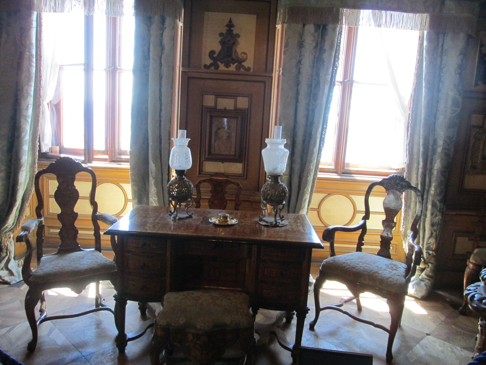
The interior showed the another aspect of this dynasty glory.


(The end of my summer trip to Slovenia 2016, thanks!)