<Bus trip from Zell To Lienz>
There’s no direct bus nor train from Zell to Lienz. I left Zell at 9:30 am on July 18 by bus for Mittersill, about 25 km to the east. From Mittersill, there is only a bus connection to Lienz in East Tyrol running north to south through the Felbertauern road tunnel of 5.3 km long at an elevation of about 1630 m within the Hohe Tauern mountain range. In the 14th century, traders carried salt, ice, and copper from north to south over the Felbertauern Pass (2481m) to northeastern Italy. Goods such as wine, velvet, and silks were brought over the pass from south to present day Austria and Germany. Through the bus window, I enjoyed viewing quiet and scenic mountain valley landscapes, while imagining those good-old days’ adventurers. On the middle of the trip, the bus stopped at Matrei, well known for an access point to the Großvenediger peak (3,657 m), the 2nd highest in Austria.

It was just 15 minutes before noon that I arrived at the Lienz train station.
<Lienz, a medieval town>
From the station I got a taxi to go to 'Goldner Stern', a pension for my three days stay in this town. The taxi driver looked like a cheerful Italian, who listened to Mozart violin concerto while driving. I've never seen before a taxi driver who indulged himself in listening to classical music in his car. After check-in, I walked toward the city center and looked for an Italian restaurant. I felt like eating spaghetti here, not Austrian beef cuisine.
Geographically Lienz is lying 40 km north from the boarder with Italy and has an atmosphere of a small medieval town with the population of less than 12k. The streets and the city markets lured me to think of its glorious days during 13 to 15 centuries. I instantaneously loved this kind of medieval atmosphere.
For mountain hikers, Lienz represents one of the alpinist’s holy Meccas, which is surrounded by the Hohe Tauern mountain range in the north and the Dolomites in the south stretching to the northern Italian Alps. This town provides a good access to varieties of spectacular landscapes.

History of Lienz
Lienz first appeared in history under the name of Luenzina, in a deed issued by the Bishop of Brixen about 1030 when it, together with the neighboring area, belonged to the Patriarchate of Aquileia, an episcopal see in northeastern Italy, at the era of the Holy Roman Empire. Afterwards it was purchased by the Counts of Gorizia, who were originally officials in the Patriarchate of Aquileia, and they chose Lienz as their residence. They started to reign the Country of Gorizia from 1127. This town flourished as a marketplace on the trade route from Venzone in Italy to Salzburg and received city rights in 1242. In 1278 the Counts completed the castle Schloss Bruck, which served as their local seat until 1500, when the Austrian imperial House of Hapsburg succeeded all its estate.


<The views from the castle Schloss Bruck>
Schloss Bruck
After strolling around the city center, I headed for the castle as my first must-see here, which was in the walking distance from the city center. This castle has been well preserved and is now used as a city museum, where they exhibited the works by Albin Egger-Lienz (1868–1926) when I visited. Ascending old wooden stairs in the tower, I could get a whole picture of the city.
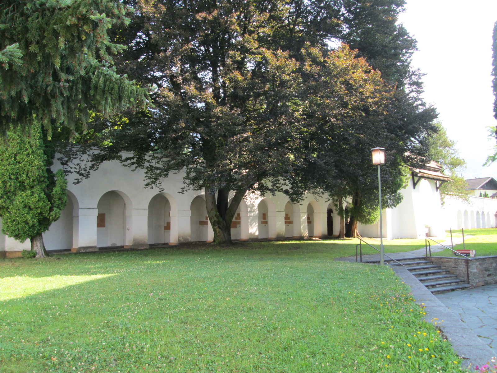
 <on the way to the castle> <the entrance>
St. Andrew’s Church
Next morning, it was a fine and restful Sunday, so after breakfast I strolled out across the river Isel to the nearby St. Andrew’s Parish Church. This church was built in 1450 on the Romanesque foundations with its porch and crypt constructed in 1204. The area including St. Andrew was Christianized from Aquileria in north-east Italy in the 4th century. I arrived there before their Sunday service began. A middle-aged woman came from nowhere and humbly gave a small bouquet of flowers to the photo of a little girl at a kind of a family vault on the church wall, while her dog was quietly waiting. This was touching.


Gradually more and more people came to the church for attending to a Sunday service, whom I followed and sat on a wooden row seat at the back. During the service, although I could not understand what the priest and his assistants were saying in German, but I could guess fairly well what was going on, because I had experiences to attend to such christian church services while I was in elementary school in Japan more than 60 years ago. When people sang a hymn, I stood as well as other attendees and also made a donation. When the service over, somebody sitting nest to me offered his hand to shake mines. I am a Buddhist, but respect people's religious minds to seek for peace and happiness in this troublesome world. Hearing people hymning in tune with the 17 century-made pipe-organ, I thought that eventually we were the same human beings no matter what a different religious background we might have.

Zettersfeld
Returning to the pension, I was wondering how I should spend the afternoon as I had no plan for that Sunday. I asked the mistress of a pension for some advice in exploring the local nature or culture that Lienz has to offer. Thanks to her advise, I headed for Zettersfeld which was situated north of the town and truly a gateway to the Hohe Tauern National park. It took around 40 minutes by walking to reach the cable car station.
 The cable car was not operated with nobody lining up in front of its gate when I reached. It was a lunch break time. I was a first passenger when it resumed a operation at 13 pm and a cable car lifted me very smoothly to the summit station at 1,800 m high through the alpine pastures spread under my feet.

With no definite plan I headed toward the Neualplseen lakes, the most popular site in the area, which was located between the peaks of Schleinitz (2,905m) and Goiselemandl (2,433m). I enjoyed in viewing the Lienz Dolomite range standing solemnly to the south in Italy. But at around 15 pm on the way, it started to rain and people warned me that the cable car might stop operation earlier before 4 pm. So I decided to return back. I regret that I had not reserved an extra day for hiking in Zettersfeld.
(to be continued; next "Kals")
Related blogs are;
Zell Am See - A senior hiker on Austrian Alps (2) posted on Sep. 9, 2015
Mt. Schafberg - A senior hiker on Austrian Alps (1) posted on Aug. 4, 2015
<From Salzburg to Zell Am See>
On a train down to Zell Am See from Salzburg, I sat next to an old lady. There were few people in the car and as she was so friendly that we started to talk at once. But soon we came to realize that it was not an easy task for us to continue chatting between German and English. Just avoiding uneasy silence of nearly two hours until we both reached Zell, I got an idea to use a translation tool on my smart phone, which I had never used before. I put an English sentence into this device and showed her its translation result in German, and she put a German word in her turn. Thus we spent a pretty good time, but I was puzzled by her remark on cows when I told her that I was going to hike on Austrian Alps. It was not until the very next day when I met a herd of cattle grazing on my way at a high altitude near the Schmittenhohe summit, I realized that not only hikers but also cows liked to spend a good time on high altitude in summer time. Zell Am See is a small town by the lake surrounded by mountains and provides good access to diverse hiking trails, which allow people with different levels of experience and physical strength to enjoy hiking according to their own tastes. I went to the tourist information center at first and got a very practical hiking map and useful tips on choosing my next day's hike.

<Schmittenhohe - 4 LAKE HIKING>
In the next morning, I rode up on the lift to Schmittenhohe and from there walked along the trail No.50 dubbed as “4 LAKE HIKING”, which was one of the recommended routes for a hiker with some experience by the city's simple hiking guide. Starting the Schmittenhohe top with the height of around 2000 meter, I could easily trail the path per guideposts. It was a really nice walking, breathing in cool mountain air and having a great view of Austrian alpine scenery on a sunny summer holiday.


<Kitzsteinhorn - Gipfelwelt 3000>
In the afternoon after 4 LAKE HIKING, I descended to Zell and headed for Kaplan on a local bus to see Kitzsteinhorn glacier and have a panorama view from Gipfelwelt 3000 lookout.


While planing in Japan, I was thinking about taking part in a guided tour to the Kitzsteinhorn summit (3,203m altitude) led by a state qualified alpinist. But this requires the ascent of 200 meter altitude being fastened to a rope with other climbers and I was not so sure of it, so abandoned this idea. Instead, I just changed to a different lift up three times, which took me to 3,000 meter altitude so easily in less than 50 minutes. At the top, I walked down to an ice field, excited with the cool touch of summer snow under the strong summer sunshine just as kids playing with sleighs. Back to the Gipefelwelt 3000 lookout, I enjoyed the magnificent view of mountains in the Hohe Tauern National Park.
<Pinzgauer Spaziergang>
This hiking trail also starts from the top of Schmittenhohe lift and stretches along the mountain ridge of Kitzbühel Alps to Saalbach. It requires 6 hours of pure walk, all-day hike so that good physical condition and strength is a must. But the guide book stresses this hike as one of the most beautiful high trails in the eastern Alps with magnificent views of the Kitzbühel Alps and Hohe Tauern range.
I met a senior hiker from London at the pension. He also came alone to challenge this route to celebrate his 61 years birthday. But on the next day while chatting, he persuaded me not to take this route as he had been forced to retreat somewhere on the way due to the long walk under the heated sun, saying that it would be very tough for a senior lonely hiker like him and me. Anywhere I decided to go on this trail as far as I could.


Around two hours walking from Schmittenhohe, I encountered a senior German hiker returning from the opposite direction and we talked for about one hour, considerably long time for a hiking rest, siting on rocks under the shadow of trees. He started earlier with a tour group, but decided to return to Schmittenhohe. He was of almost same age as me, we felt some familiar feeling each other. He had experiences to visit Japan several times as a chemical company's engineer before retirement, saying he knew some people of the Japanese chemical company which I'm currently working for. Walking alone on a desolate trail makes sometimes a lonely hiker talkative.

30 minutes after waving good-by with him, I reached the mountain hut dubbed "Hochsonnberg Alm" situated at 1841m altitude. This hut welcomes hikers with a menu of specialties and a magnificent view of snow-capped Kitzsteinhorn mountains. Instead of a beer, I ordered a juice, a kind of lemonade, which looked like just water, but tasted subtly sweet and very refreshing. The master said they made this with mountain cool water and asked me how I liked it. It was certainly the most refreshing juice I ever had drunk.


A gently sloping uphill from the hut took me to the saddle point called Rohrertori, where there were no human beings but cattle and horses grazing peacefully and some of them took a suspicious glance at me when I passed by. But this was just the entrance of a maze that made me losing my way. There was certainly a guidepost that might have indicated the right way, but it was written in German with an unfamiliar place name. I tried to make a detour not to interrupt those cattle and horses grazing. I continued to walk on for more than one hour until I found it was not the right way to Saalbach. On this Alm, I learned that broader trails are for those cows and hikers should choose rather narrow roads. When back to Rohrertori, I lost two hours and decided to return to where I came from just as my two fellow colleagues.
<Kaiser Franz Joseph Hohe>
On the 4th day in Zell Am See, I joined in the bus tour to Kaiser Franz Joseph Hohe conducted by National Park Rangers. I had been wondering whether I should rent a car to go there, but Ms. Mondre of the pension looked for a nice bus tour and made a booking for me. It was very economical because of its discounted fee of 22euro thanks to a Zell Am See Card and also eco-friendly. I got in the bus at 9:00 at Zell and a park ranger started to explain us in English about the today's tour and the nature of the Hohe Tauern National Park. The bus drove on the Grossglockner High Alpine Road, one of Europe’s greatest alpine road,which connects Bruck and Kaiser-Franz-Joseph-Höhe (2369m), 48 kilometers long with its 36 hairpin curves and a splendid view of glacier mountains.
 Our first bus stop was the Alpine Nature Show Museum at an altitude of 2260 meters above sea level, which highlighted its local mineral and flora exhibition. From the nearby lookout, I enjoyed the scenic view of glaciated peaks including 3564m Grosses Wiesbachhorn.


At 12 o'clock the bus arrived at Kaiser Franz Joseph Hohe Visitor Center (2369m). I followed our park ranger to the crystalline Wilhelm-Swarovski observatory, listening his explanation about the area's fauna, rapidly retreating
Pasterze Glacier and climbing route to the top of Mt. Grossglockner; "The Grossglockner is the Austria's highest mountain, 3, 798 meters high above sea level with the longest glacier in the eastern Alps, the Pasterzeand. You can see lovely marmots socializing each other near the center and if you are lucky enough, the mighty ibex might loom up in the fog." But looking at the retreating glacier made me realize how the global warming has presented itself as a real threat to human beings.


We had two hours to explore the site before 14 pm, the departure time of bus. I took a lunch at a restaurant with a great view of Grossglockner behind the back of ibex statue, ordering "Leberkase", fried egg with potato salad for 9.8 euro and 0.3L draft beer for 3.2 euro. In return, our bus descended the same zigzag road back to Zell and stopped in a half hour at Fuscher Lake (2262m) for a short coffee break. The lake was calm with the sound of melting snow flowing into it and reflecting the surrounded mountains images. On the road side, people gathered to see a marmot coiling around the neck of his master.
 The Grossglockner High Alpine Road had been constructed between 1930 and 1935, during the Great Depression, around 80 years later after the visit by the Emperor Franz Joseph. Although the construction was motivated by the people's anticipation toward the opening of motorized tourism, they are also eager to protect the area's natural environment. The local people advised me not to use rent-a-car, but recommended me to take part in a bus trip. I heard the touring bus was launched in 2012 for sustainability reasons as well as offering an easy access to the region's unique natural beauty.
(to be continued; next "Lienz")
The other blogs related to "A senior hiker on Austrian Alps"
1. "Mt. Schafberg from Salzburg" posted on Aug. 4, 2015
Why Austrian Alps?
♪♪♪--- “The hills are alive, With the sound of music ---“
This is the opening song sung by Julie Andrews as Maria in the film “Sound of Music” with the overwhelming pristine alpine meadow catching our eyes. Many of my friends were enchanted by Julie Andrews, the Trap family's lovely children and the romantic mountain scenery when we were young. The Austrian Alps seemed to promise me ideal hiking opportunities with fascinating landscapes and well organized hiking trails at varying altitudes and levels of difficulty.
So I decided to go hiking on Austrian Alps for this summer vacation.
I had traveled in Austria for two weeks from July 9 to 22, 2015, visiting Salzburg, Zell Am See, and Lienz with Vienna but just as a transit from/to Tokyo, Japan. Both Zell Am See and Lienz are small country towns surrounded by mountains, providing a good access to the Hohe Tauern National Park, the largest nature reserve in Central Europe with an area of over 1,834 km2.
<Zell Am See> <Lienz>

Mt. Schafberg in the Sazlzkammergut
On the 3rd day in Salzburg, I went to Mt. Schafberg, 1783m high in the Sazlzkammergut, where the old cog trains are going up and down between the summit and St. Wolfgang, a small town at the shore of Wolfgangsee Lake. This cog train is also shot in the picnic scene of the cinema “Sound of Music”.
I took the public Postbus No.5 from Salzburg central bus station to St. Gilgen, where I got a round trip ticket for the summit of Mt. Schafberg, including the rides on ferry boats to St. Wolfgang and on the cog trains.
<St. Gilgen> <Wolfgang lake>

St. Gilgen is located 25 km east of Salzburg and well known for the home of Mozart's grandfather where his mother was born. The above photo in the right side shows this house, which stood just next to the ferry port. The ferry boat took me to St. Wolfgang in less than one hour, where I changed to a cog train connecting between the summit of Mt. Schafberg and the shore.
 The Salzkammergut area called as Lake District is comprised of 76 lakes surrounded by numerous mountains with the height of around 2000 m. The name Salzkammergut comes from "Estate of the Salt Chamber" and the salt had formed the basis of the prosperity of this region along with Salzburg from the prehistoric era through the Hapsburg Monarchy to the middle of the 20th century.

On the summit I found a nice restaurant and enjoyed beer, having great views of the surrounding mountains and lakes. It was a rare experience for me to drink a glass of beer on the top of mountains with no care to further effort to walk, just relaxing until the designated cog train down to the lake would leave the summit station.
(to be continued; next "Zell Am See")