Tuesday, September 30, 2014

Depoi Bay on Oregon Coast - Senior backpacker at the wheel (4)

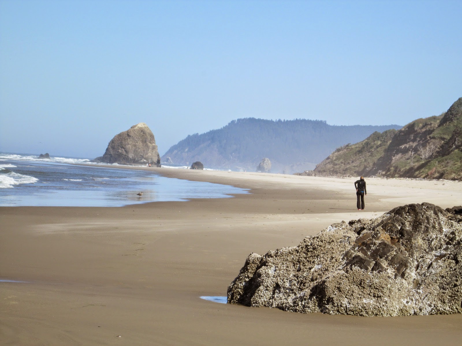
 I drove from Astoria south to Newport on U.S. Route 101 along the coastline near the Pacific Ocean. On the way I dropped at Arcadia Beach exploring the white sandy ocean beach and enjoyed an endless ocean view from Winema Wayfinding Point. I was enchanted by the incredible scenic beauty of Oregon coast under the blue sky.


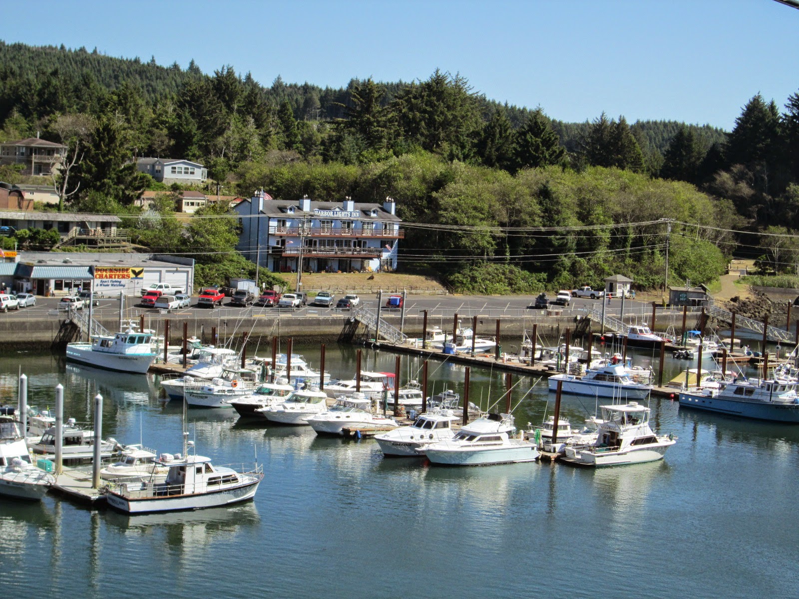
 Arriving at Depoi Bay, 121 miles south from Astoria, at 2 pm, I looked for a chartered boat to watch Gray whales near the shore. Dubbed as the "Whale Watching Capital of the Oregon Coast", Depoe Bay with The Whale Watching Center is a good spot for tourists to locate and watch whales almost year around as they blow, dive and breach.


  Gray whales migrate past the Oregon coast twice a year. From the last week of December to the first week of January, they are heading south from Alaska to warm water lagoons off northern Mexico, while in spring time beginning the last week of March through June, they are heading north back to Alaska. 

 But even in summer and fall off, we still have a chance to see Gray whales. Because some of them do not migrate all the way north to Alaska and spend from late June through October off the coast of Oregon. They are called as resident whales and number about 200. About 40 of these hang out off the Depoi Bay, spending much of their time feeding on shrimps.

 There were three whale watching chartered companies here, but none of these was going to sail a boat out this afternoon due to strong wind. I decided to make a reservation for tomorrow’s 8 pm zodiac, a small boat with a maximum of 6 passengers on board, operated by the Dockside Charters.
Next morning when I came to the dock harbor, I found that I was a only passenger for them. With life vest on, my captain took me out into the Pacific Oceans on the zodiac boat, which pitched and rolled heavily so that I found it not easy to hold my camera tightly focusing on whales moving.    


 In order to take good shots of Gray whales's dynamic moves like the blow, the breach and the dive, we need to know their swimming pattern. They often stay under water for 3 to 5 minutes when they are eating. If they have been down for 5 minutes, they usually blow 5 times at regular intervals of 45 seconds when they surface to replenish their oxygen supply. I was always puzzled as to where they would appear, and then suddenly hearing my captain's shouting, turned around toward the direction where he pointed and tried to take a shot of them in the next 45 seconds.


  Next time, I'd love to see a bunch of 18,000 gray whales migrate south from Alaska along the coastline of Oregon in December.

(to be continued; next to Columbia Gorge)
Tuesday, September 23, 2014

Astoria on Oregon coast - Senior backpacker at the wheel (3)

 From Paradise Inn, I headed for Astoria on the northern edge of Oregon coast, where the Columbia River flows into the Pacific ocean. In 1811, the first settlement was established here for fur trade, which marked the oldest record west of the Rockies. The town especially flourished in the wild salmon fishery, which lined the town streets with banks, wood-steepled churches and Victorian mansions. 
 I arrived at Norblad hotel and hostel before 2 pm, which was too early for me to check-in. So I went to the nearby waterfront and took a late lunch there with beef jerky and snacks enjoying a nice view of an anchoring cargo ship, seagulls and Astoria bridge over the mouth of the river.  


One of the pleasures for a traveler from Japan is to dine and taste local beer at a restaurant with microbrewery. Here as well as in Portland, I looked for such a restaurant or pub. Luckily there stood the Fort George Brewery & Public House just in front of tonight's accommodation. The pub's name with its ALE beer reminded me that Astoria was under control of the British authorities from 1813 to 1818 and it was known as Fort George


  Sitting on the bar counter, I was wondering which one I should start to pick up from their varieties of microbrewery beers on the board. Their 14 different crafts original beers bear all strange names like "Divinity", "Working Girl Porter", "Wasabi Ginger Ale", "3-way U.P.A." and etc. In Japan the four major beer companies dominate the market, and I feel sometimes their beers taste almost the same and rather boring. But here any beer looked like boasting of its uniqueness with fresh locally obtainable ingredients, which quenched my thirst tenderly.


  I liked Astoria, a quite and small town, which made me feel some nostalgia with its flavor of history. On the next morning before departure, I walked around looking for a cafe shop near the Norblad together with a young hosteler. She was also coming to Astoria alone from Portland for sightseeing.  

(to be continued; next to Depoi Bay on Oregon Coast)

Friday, September 12, 2014

Mt. Rainier - Senior backpacker at the wheel (2)

 The national park of Mt. Rainier is located in Washington State at a distance of about 200 km north from Portland, Oregon. I departed Northwest Portland Guesthouse, Hostelling International, at 8:00 and after filling up at a service station, took ramp left for I-5 toward Seattle, heading for Paradise Inn, where I made a reservation for two nights stay for hiking.


 Mt. Rainier stands 4,392 m, 14,410 ft, above sea level, highest in Washington state with 25 named glaciers across 9 major watersheds and subalpine wildflower meadows ringing this icy volcanoParadise Inn is located at the height of 1642 m, the highest mountain lodge of this area with its name derived from its frontier James Longmire’s daughter-in-law’s remark at her first sight, “Oh what a  Paradise". 


 From the lodge, there are several hiking trails. Before climbing I had consulted with a information centers’ young lady about the possible routes, but I changed occasionally the course while hiking so that I covered finally three different trails; Deadhorse Creek Trail, Skyline Trail, and Lakes Trail, all which required me total 9 hours, taking many photos of subalpine wildflowers. I had been almost all alone with so few hikers I met on the way and it looked like I’m only one guy hosted by these beautiful wildflowers, singing to myself the old 1960s hit song of "King of the Road".

<Deadhorse Creek Tr.>
  It was misty with morning drizzling rain when I departed the inn at 8 am. The trail was clearly guided with sign posts at major branch points and subalpine wildflowers like lupine or Lewis’ monkeyflower lined up along the trails. About a half hour after I started to follow the trail, a mother wild deer with her baby suddenly appeared ahead of me. They were grazing grass, trying to ignore me but very cautious when I tried to take photos of them.   


 With an hour walking, I reached to Glacier Vista, 6336 ft, a relatively broad open area, from which one could have a closer view of the Nisqually Glacier on a fine day. 


 <Pebble Creek>
 Before heading up to Panorama point, I made my way along the path to Pebble Creek which lead to Muir Snowfields. After a half mile ascending I found the sign board which said something like “Dangerous zone from this point to Muir Snowfield. Even experienced climbers could have died.” I advanced 10 minutes further and found the trail merged onto the snowfield, which made me decide to return to Panorama Point.


<Panorama Point to Sluiskin Falls>

Panorama Point
On a clear day, I could have seen from this point Mt. Adams 45 miles to the south, Mt. St. Helens 46 miles to the southwest, and Mt. Hood 96 miles away in Oregon. From this view point I followed the trail further upward to reach the today’s highest point 7000 ft. and then descended gradually to the cross point between the Golden Gate trail and the Skyline trail. I changed again my original plan and took the Skyline to Sluiskin Falls. 


As gradually the weather became sunny, the subalpine wildflowers meadows appeared before me. How happy I am!


 < Lakes Trail to Reflection Lake >
 Following the skyline trail about half mile, I met a senior couple and following their advise, I  turned left to make my way along the Lakes trail, giving up the idea of returning to the inn along the skyline trail having a late lunch. I saw many small lakes, flowers, and forests on an up-and-down walk.


On a clear day I could expect to see Mt. Rainier’s image reflected in the surface of Reflection Lake, but it became darker and started to rain fiercely as I approached the lake, so I had no privilege to see the great image of this holy mountain. 


(to be continued; next to Oregon Coast)

Wednesday, September 10, 2014

Senior backpacker at the wheel on Oregon roads

I got a driver’s license 10 years ago at the age of 54. Since then, driving on US highways to visit national parks for hiking has become one of my dreams. In Japan we don’t need so much a car to access to entrances for mountain hiking, but things are different in US. I don’t rely on a tourist company's packaged tours. My traveling style is just like backpackers’, so I like to go as wind blows like a wanderer and do what I feel good at that time.

 The issue was driving on US roads. My annual driving miles in Japan average less than 3,000 miles and I have had no experience in using rent-a-car even in Japan. Not only inexperience in driving, but also I need to consider my physical handicaps like allergic eyes and disabled right hand due to polio with which I was struck at five. 
How I can manage to drive safely and be ensured to reach my destinations as scheduled?
I have planned routes carefully since one year ago and bought a US Garmin's portable navi, which I tested for Japanese roads and set up all possible addresses and routes into it. 
And on arrival at Portland, Aug. 29 Fri, 2014, I immediately rush into a AT&T shop to buy its prepaid phone, Nokia Lumia 635 mainly for security reason while driving.


 With all these precautions and bless of good weather, I really enjoyed my summer vacation and found driving on US roads a lot of fun as well as hiking in beautiful US National and natural parks. Let me present my nice memories here one by one;

  • Mt. Rainier 
  • Oregon Coasts
  • Columbia Gorge
  • Portland
(to be continued)