Tokyo station is situated at the heart of capital Tokyo with its Marunouchi-side leading to the carriage-drive way for the Imperial Palace, formerly known as “Edo castle”. The restored red-brick building on the Marunouchi side of the station is around 35 meters high with modest three stories above and two under the ground, stretching 335 meters along a north-south axis. With more than 4,000 trains coming and going every day, there are 14 railroad lines originating at Tokyo station, including the Tokaido and Tohoku Shinkansen Bullet Trains. From here you can go almost anywhere in Japan as you want.

The station also provides tourists with the preserved classical style hotel which can accommodate 150 guests and with the huge shopping mall of total 220 shops on its 1st floor and basements, including many take-outs which sell about 170 of varieties of “Eki-ben” coming from various parts of Japan for your lunch, dinner or breakfast on your train seat.

But that's not all that it has to offer. Before you rush through a ticket gate for a platform, take a glance up, for example, to the ceiling of the South Dome at Marunouchi-side. You will notice its unique cathedral-like dome look of octagonal shape, which was designed by the first Japanese architecture, Dr. Kingo Tatsuno, a century ago. One of his masterpiece, Tokyo station building was burnt down by the U.S. air force raid during the world war 2, but in 2012 it was restored to its original style after a five-year renovation effort. The building is not just a convenient and modernized facility for transportation, but it also presents itself as an historical monument which remind us of the old Meiji era's spirit when Japanese had kicked off toward the modernization after 300 years national seclusion.
 On Dec.20 2014 last Saturday, Tokyo station celebrated the 100th anniversary of the opening. The station was so crowded and I saw a lot of people flocking to buy various items as souvenirs like the specially designed Suica prepaid IC cards to commemorate this event. I'm completely indifferent toward such souvenirs, but in a sense it shows that many people love and be proud of this historical building. I felt like exploring more about this historic and cultural heritage of Japan, which stands with dignity amid a bunch of tall contemporary commercial buildings surrounding it.
(to be continued)
While those ancient Sicachi-Alyan artists had been carving their imaginary creation on the rocks along Amur between 12,000 B.C. and 500 B.C., the ancient inhabitants in Japan were making the so-called "cord-marked" potteries with the decoration of impressing cords into the surface of wet clay. This entire period is called as Jomon which literally means "cord-marked" in Japanese. Was there any intercourse between the two ancient neighboring people? And could we prove it in a scientific manner or by identifying some similarity in their cultural archaeological remains?
Prehistoric culture in Japan
The Jomon culture in Japan is classified as Neolithic and divided into five phases. The earliest phase of this culture developed in Hokkaido and Tohoku, the northern parts of Japan, which is considered to have begun about 12,000 B.C. when Japan was linked to continental Asia as a narrow peninsula. Some scholars believe that the early Jomon culture was brought from Siberia via Sakhalin and the people of this culture were the ancestors of the present-day Ainu. If so, the ancient culture of Sycati-Alyan could have been carried in some extent to the Japanese Archipelago by them. Could we recognize any similarity between the various design patterns found on Sikachi-Alyan's rock carvings and those of Ainu or Jomon people in Japan? This is a mystery.
Jomon Pottery
Jomon pots are the oldest ones in the world. Pottery was first invented by hunter-gathers living in Japan, China and Korea during the last Ice Age about 14,000 years ago. Take a look at some photographs of Jomon potteries with seemingly snake or vortex designs, which I found on Internet although their exact creation dates were not specified. Is it possible to connect these design patterns with those found in Sycachi-Alyan petroglyphs from the artistic view?

The late Prof. Hourai of National Institute of Genetics, who happened to be my senior at the mountain trekking club in the university, had sought for the root of Japanese by analyzing mitochondrial DNA. He claimed that;
- the contemporary Japanese are of mixed Jomon and Yayoi parentage.
- the Yayoi people came from the mainland China through the Korean Peninsula during the periods from 300 BC to 300 AC.
- the Jomon people came from the north in the Jomon era, the time dated back to Prehistoric Japan from 14,500 BC to 300 BC, when the Japanese Archipelago was connected to the Eurasian continent.
I also find the interesting description on the web site by the NPO "Amur Region Historical Heritage Fund". It suggests that there existed some cultural contacts between the inhabitants of the lower Amur and Ains' ancestor in pre-historic era. Let me cite this below;
"In ancient times there were contacts between the culture carriers of the Amur river, Ains' ancestors and tribes of Indonesia and Polynesia. A witness of such links is a wide spread of the vortex ornament, that has the Snake cult as a basis. Presumably, this was further spread out and in remote Australia and Vietnam. The culture of the Lower Amur neolithic tribes is strongly expressed in the Sycachi-Alyan rock drawings and, most likely, had the influence far bound the frontier of this region."
It's a nice experience for us to realize how we've come a long way.
References;
(1) The web site of "Amur Region Historical Heritage Fund"
(2) "Down The Amur from Khabarovsk to Nikolaeusk-na-Amure"
(3) "Ancient Art of the Amur Region - Rock Drawings Sculpture Pottery"
by Alexei Okladnikov
(4) "Jomon period" from Wikipedia
(The End of this series "Rock artists in Sycachi-Alyan, 12 Millenniums ago ".)
To know more about Sikachi-Alyan, I made my way
to the Far Eastern State Research Library on Muraviev-Amurskiy street near the museum. It was the old red-brick building of early 1900s. On the left to this library, there stands the Holy Assumption Cathedral Church, Uspensky church in Sobornaya (Cathedral) Square, which is one of the largest Russian Orthodox cathedrals in the Russian Far East. From the Cathedral square people can descend to the the bank of great Amur river. This is the one of the most spectacular viewpoint of the river. Unfortunately, as the river was still flooded, there were no excursion ship in operation for tourists.

 The Library looked a little bit majestic. But as I entered into the building on Sunday afternoon, I saw an old woman sitting on the reception desk. She was kind enough to take the trouble to issue a permission card to let me in, although I was absolutely a stranger from an Asian country and her English was as terrible as my Russian. Here I found interesting legends related to Sycachi-Alyan in the book titled "Down The Amur from Khabarovsk to Nikolaeusk-na-Amure"
Legend in stones
Some long time ago in the location of the present-day Sycachi-Alyan a small nomadic camp existed. Its inhabitants led a quiet life but once misfortune came. The volcano awoke and burst out the fiery lava that in an instant destroyed the small camp and everything alive around it. Only two persons got saved, a husband and wife who had gone hunting across the mountains. Upon coming back home they saw a terrible picture. The land was covered with ashes and there was nobody alive around. For several days they shouted and cried in distress until losing voice. In the meantime the earth got cool and started looking like a choke-cherry cake. And the stones of the Amur river bank were still soft. The husband and wife strolled along the river drawing on the stones by finger. They wanted to leave memory of the perished and the native camp. The local inhabitants believe that these people who avoided death were the predecessors of the Nanai nationality.
Legend of the three suns
In Sikachi-Alyan they will tell you the legend of the three suns:
"... Many centuries ago things were different. We had many animals in the taiga, much fish in the rivers, and forests were rich in berries, nuts and medicinal herbs. But once three suns were seen in the sky and they burnt the earth so it grew black, the trees and herbs got extinguished. The heat was so strong that the birds' wings were broken. They say then ravens appeared among birds. The people trying to find refuge from the three suns excavated deep dugouts where they stayed till late at night daring to come out only in the evening to see the horrible picture: burnt earth and dead fish in the river. The people began praying to the God of the Earth - Dragon Kailasu felt sympathetic and sent his twin sons Ado. The brave warriors took sharp arrows and shot two of the suns that rolled down to the underground world so order reigned on earth again. And the twin brothers became gods since then and the people called them Ado-seveni ..."
The plot of these two legends today can be seen in the art of the local painters and craftsmen, in the bright choreography of the folk lore ensemble Aioga and of the Ethnographic Museum exhibits.
(to be continued)
Sycachi-Alyan petroglyphs
First let me cite the description about the Sycachi-Alyan petroglyphs from the web site of "Amur Region Historical Heritage Fund<(1)> "
"The Sycachi-Alyan petroglyphs are the disguise masks of the animals, birds, snakes, boats, pits with concentric circles; anthropomorphic images. In total, there had been found 300 drawings (presently only 160 are left). The images are created by the stone instrument by a deep channeled striking method and by the iron tool in a threading style technique. The graffiti belonged to the Mesolithic time (early Neolithic), early Iron Age and early Middle Age and are dated the 12 millenniums B.C. to first half of the millennium 1 A.C."
I don't know how the creations of these 300 drawings found in total lined up chronologically, but looking at the several Sycachi-Alyan rocks displayed at the front garden of the Archaeology Museum, it seemed that there were two prominent eras in which the Ancient inhabitants particularly got frantic about the rock arts with more than 5,000 years separating them.
Mesolithic era (early Neolithic, 10-13 millenniums ago)
In Mesolithic, when the art of clay pottery production was still unknown in the Lower Amur, the first carvings of animals and birds had appeared on the Sycachi-Alyan stones. These elks, horses and oxen are, most likely, the samples of the ancient fauna of the Lower Amur.
Bellow are the Sycachi-Alyan rocks at the Archaeology Museum; The museum signboard says in Russian that they are "the most ancient rock carvings (petroglyphs) created in the Early Neolithic (10-13 thousand years ago)"

Neolithic era (6-5 millenniums ago)
In the Neolithic, a culture of the fisherman and hunters was developing. A particular feature of the neolithic culture is rich developed curvilinear ornamental: spirals, "Amur wicker-work" (a net from the interweaving curved lines). In Neolithic, and maybe even earlier, the anthropomorphic drawings had appeared - masks or disguise, that can be seen on the Sycachi Alyan stones.

Various masks on the rocks;

Actually, I see more elaborate and thinner curves on more abstract images in the creations of Neolithic. I imagined that this advancement were brought about by the development of their striking tools along with the change of their aesthetic appreciation.
I looked for the Nanai souvenir shop in Khabarovsk to know the arts and crafts of modern Nanai people. Could we identify any similarity between the images on the Sycachi-Alyan rocks and these modern arts by today's Nanai artisans?

(to be continued)
<Trip to Siberia, Russia>
Sycachi-Alyan is the Nanai indigenous settlement on the right bank of the Amur, located 75 km north from Khabarovsk. map to Sycachi-Alyan
Its population is 300. There have been found totally 300 rock drawings of the disguised images of animals, birds, snakes, and boats, which had been created in 12 millenniums B.C. to first half of the millennium 1 A.C. One guidebook describes these rock arts as this; “It seems some powerful spirit scattered huge rocks with faces of northern gods, witch masks, scenes of hunting and those from legends and tales”. The place has been sacred for Nanai and the other Priamurye low-number peoples. The sacred complex is named Sycachi-Alyan petroglyphs after the Nanai settlement nearby. < (2) >
This mysterious place had lured me to travel to the far east of Russia, Siberia. I arranged one night's stay at the lodge of Sycachi-Alyan, two local guides who speak only Russian, and a taxis to and from Khabarovsk. I was planning to visit there while I would be in Khabarovsk for 6 days from August 29, 2013 to September 4. A local guide is must, because the majority of the petroglyphs are hardly accessible and known only by a small number of specialists, local hunters and fishermen.


But two weeks before my departure, the Amur regions were hit by the massive flooding, the most devastating in the century with the lodge standing near the river also submerged. I postponed my trip until September 19, hoping the village would be recovered from the flooding at that time. But when I landed on the Amur region, I found no transportation to Sycachi-Alyan from Khabarovsk as the route was still shut down and the city people did not care about that remote small village after the disaster. So I visited the Archeology museum which exhibits the Sycachi-Alyan rocks at the front garden, which were all brought in from the original places. I also visited the historical library of the city to look for the guide books on the Sycachi-Alyan and its rock paintings. Those provide me with the useful knowledge for this blog. I list them at the last part of this blog. Bellow on the left is the Archaeology Museum and the old habarovsk Library on the right;

(to be continued)
Portland is not so popular among Japanese as Seattle, St. Francisco, or Los Angeles on the west coast. But it has a direct flight connection with Tokyo, Japan within 10 hours. My impression toward this city before the trip was related to its environmental consciousness expressed by those words as organic, bicycle, light rail, and roses with its neighboring scenic beauties. For example, Portland is said to have almost 40 microbreweries within the city limits, more than any other city in the world. I imagined paring local organic foods with its crafts beer would be a nice pastime in Oregon, although I'm anything but a gourmet. Portland may be looking to be "weird" in a sense in seeking more naturalness and arts rather than the convenience brought by industrialization or modernization, and that's just what I was looking for in this trip as a senior backpacker.

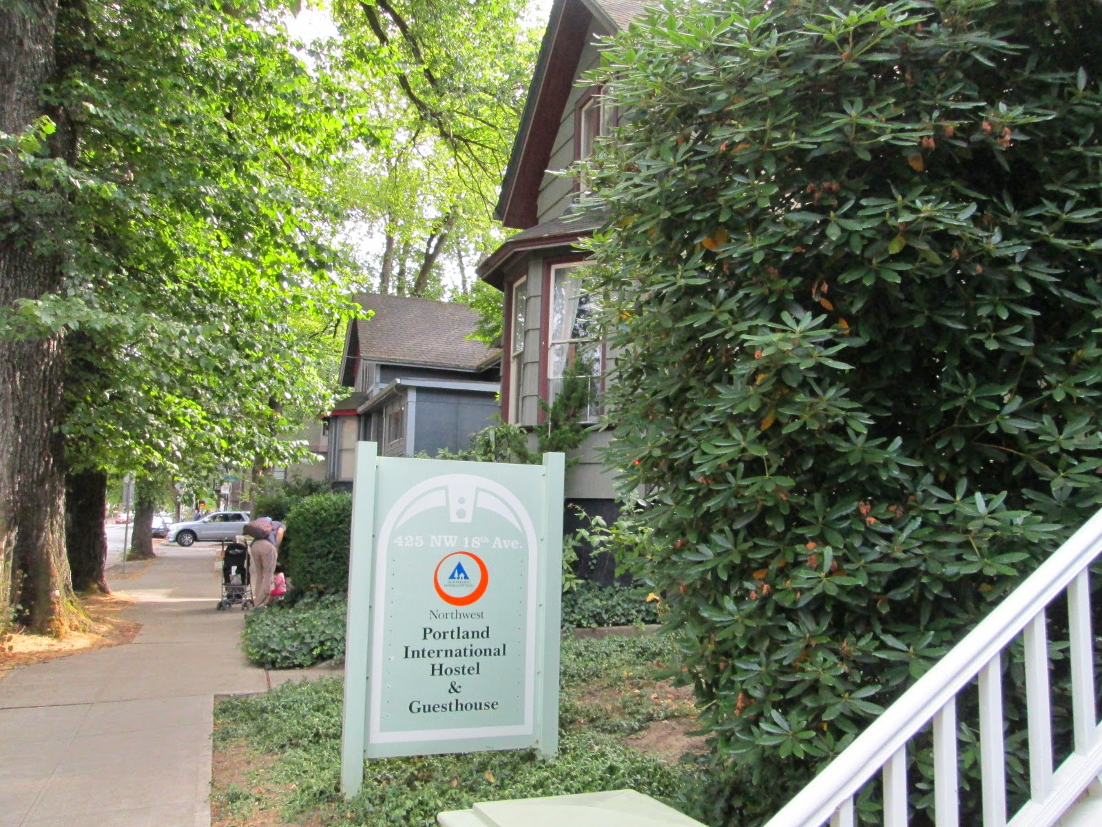
I stayed in the hostel in Portland for the first three days since I came here on Aug.29. It was located in a quiet residential area in the Northwest district of Portland, within walking distance from downtown. I made a reservation for a private room instead of a shared room considering my age. Next to my room, a young couple with small kids was staying and I also enjoyed talking with a senior tourist from the other U.S. state at the breakfast room in early mornings. So not only young hostelers, but also all generation, locally and internationally, men and women were all together here, which made me feel relaxed. The room was simple and clean without lousy TV set and impressive with the chic drawing on the wall above the tiny but practical desk. The hostel was run by young people, who were all friendly and helpful, providing guests with various activities like “Brew Pub Crawl” or “Portland downtown Walking Tour”.

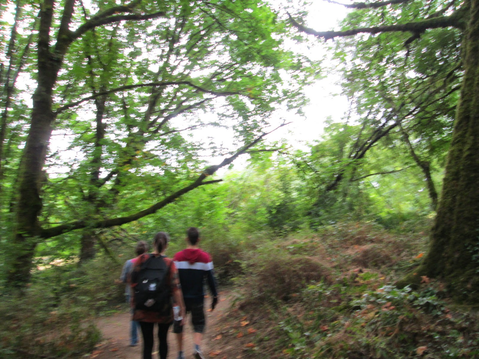
On the next Saturday, I joined in the “Washington Park Walking Tour” led by Abby with two other hostelers of a senior lady living in the south coastal area of Oregon and a young guy from Portugal who were currently working in US. We departed the hostel at 10 am and enjoyed in walking, chatting, and a nice view from the park hill and OHSU Tram, an aerial tramway in Portland connecting the OHSU Hospital on the Marquam Hill and the city’s South Waterfront.

After touring of 6 days, I came back again to Portland and stayed for two nights at a home in a residential area of the Southwest district of Portland, about 20 km east of downtown. I happened to find this renting room of an ordinary citizen's home on the Internet while in Japan. They were nice husband and wife belonging to the same baby boomers as me and I could feel some atmosphere of people's life in Portland. The room was cozy and decorated with their paintings on the three walls, bringing a kind of warm and faint breeze. I was surprised to know that she was growing tomatoes on her vegetable garden from genuine organic seeds, rejecting the Genetically modified foods, and her tomatoes tasted really sweet.

In downtown, I'd also like to recommend tourists to pay a visit to the Multnomah County Library, especially when they feel like taking a rest after their exhaustive wandering around here and there or shopping.
This library is very friendly and gives us useful information about the region. Even a tourist like me can read any book on the shelves for its vast collections. I borrowed the 3 books on Mt. Rainier based on their helpful advices and had a pleasant time on a shared desk for nearly 4 hours examining the routes I had trailed, sometimes using my notebook to reference to the Internet info via its free service.
Around their home at the Southwest, unfortunately or fortunately, there was no good restaurant, so I went east to Gresham just in the opposite direction from Portland downtown for finding a good local restaurant, where it took me about 20 minutes to go by bus. At a small restaurant which served local Northwest cuisine, I thought they served one of the best dishes ever I've experienced in U.S., listening to those mild 1960s American hit songs like Pat Boone's. In return to my night bed, waiting at the bus stop next to the Max Trail, there was a nostalgic mood in which I indulged myself as a stranger from a distant country.

Finally, a lot of thanks to God, the people I met, and the awesome nature, I had really enjoyed these 11 days in U.S..
(The End of the series of "Senior backpacker at the wheel on Oregon roads".)
This was actually my first one day
drive since I came to US 3 days ago on Aug. 29. I planned to make a round tour from Portland through Columbia Gorge, Hood River, Lake Mirror, and back to Portland. I thought this would be also a nice test driving to confirm that I was ready for safe driving in US where people drive on the wrong side of the roads.
<Historic Columbia River Highway>
Historic Columbia River Highway is a scenic highway along Columbia River in Oregon stretching from Troutdale to The Dallas. A guide book says that it was constructed between 1913 and 1922 not just as means of traveling by the then popular Ford Model T, but designed with an elegance that took full advantage of all the natural beauty along the route. Nowadays this old two-lane road runs in parallel with the modern Interstate 84. While in Japan, I checked my portable US Garmin GPS navi in simulation mode to see if it would correctly choose this scenic road instead of I-84 to go to Hood river from Portland. But this intelligent machine chose I-84 without hesitation, which forced me to input two more extra addresses on this particular road for Crown Point Vistas and Multnomah Falls.


I departed the Northwest Portland Guesthouse at 8 am and after filling up at a service station, headed for Crown Point Vistas, one of the most scenic points on this historic road. This site stands 223 m above the river and I could enjoy a magnificent view of the Columbia Gorge from the lookout of this Vista House. From here to Hood River, it was really awesome to drive on this old winding mountain road with a magnificent view of the Columbia River spread out beneath my eyes, sometimes stopping at falls like Multnomah Falls, the highest in the area.

 <Hood River Fruit Loop>
After lunch at Hood River, I turned to the Hwy 35 at the Exit 64 of I-84 heading south for Government Camp on the southern slope of Mt.Hood. I drove through the Hood River valley, a farming community famous for its varieties of fruits and wine. Along the route just before reaching to Tamanawas Falls Trailhead, I found a fruit stand lively with some visitors and parked by the near roadside. They were offering peaches, nectarines, plums, and apples in a country style of store surrounded by the lovely colored flowers garden. How sweet their peaches were! In the brochure I got at Hood River visitor center, more than 30 of local farm stands were mapped on the Fruit Loop.
 <Mt. Hood>
Passing through the Fruit Loop on Hwy 35, Mt. Hood was beginning to appear in the westward. This is the highest mountain in Oregon with the height of 3,427 meters above the sea level, especially popular as a ski resort through all seasons.

<Mirror Lake>
Oregon Route 35 merges onto U.S.26 toward Portland a few miles east of Government Camp on the southern slope of Mt. Hood. I found the Mirror Lake Trailhead 1 mile away from Government Camp. It was nearly 3 pm and although I was anxious to return to my hotel in Portland before dark, I started to walk across the small wooden bridge to make my way to the lake. This loop trail hiking is loved by people of all generation in Portland and I met many young couples, families with their kids and senior groups on the trail and enjoyed saying hello to them when we passed each other. Unfortunately it became cloudy when I reached to the lake, so I could not admire this great Mt. Hood standing in the north side from the loop. But it was a nice and refreshing two hours' hiking.
 I drove through Rhododendron and Gresham on the route 26 and came back to the Northwest Portland Guesthouse before 6 pm. It was a gorgeous round tour with 9 hours of scenic driving, hiking, and delicious fresh lunch at a Hood River's cafe lounge, which also gave me more confidence in driving on U.S. roads for the week ahead.
(to be continued; next back to Portland)
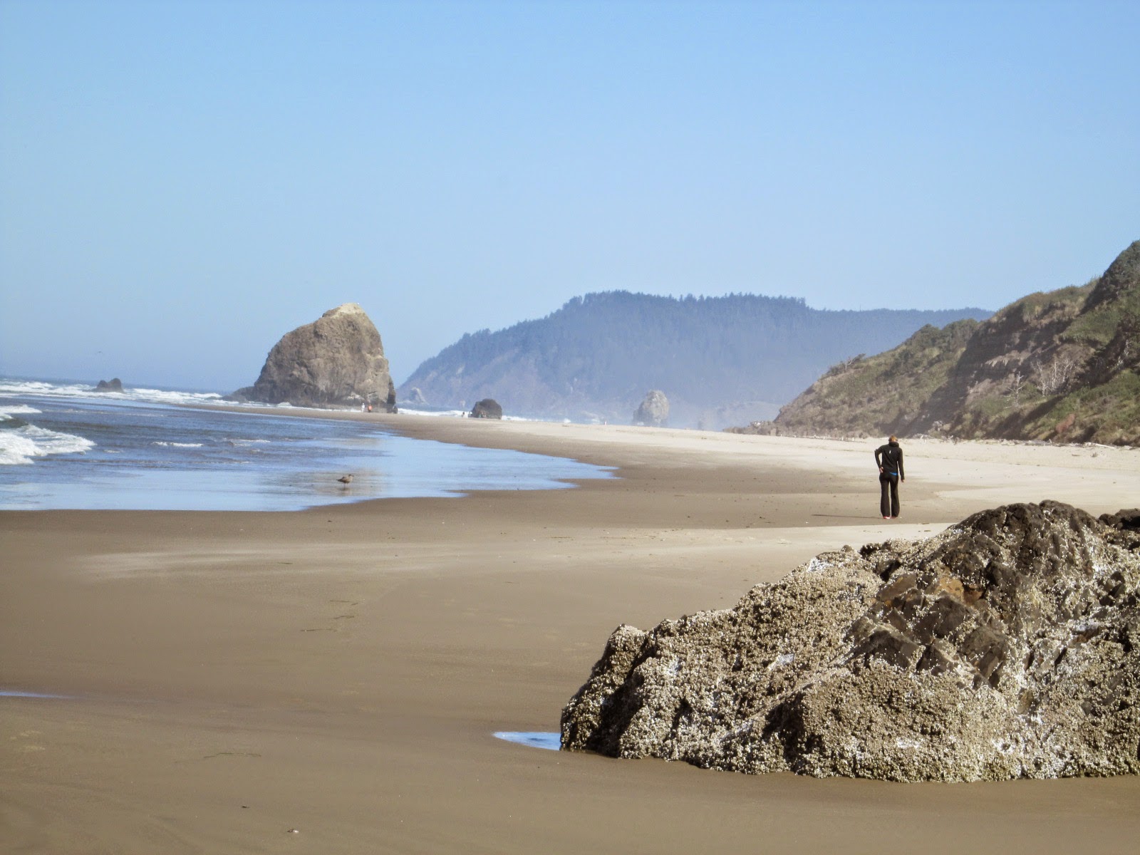
I drove from Astoria south to Newport on U.S. Route 101 along the coastline near the Pacific Ocean. On the way I dropped at Arcadia Beach exploring the white sandy ocean beach and enjoyed an endless ocean view from Winema Wayfinding Point. I was enchanted by the incredible scenic beauty of Oregon coast under the blue sky.

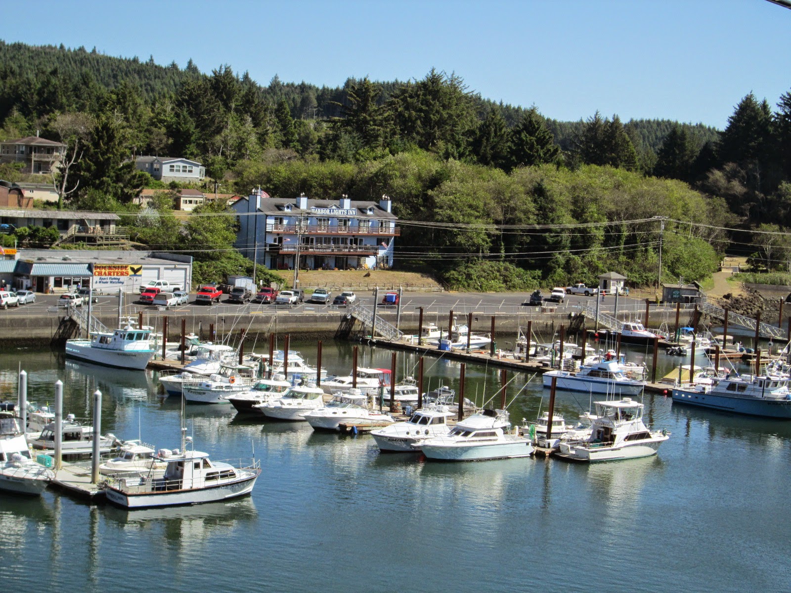
Arriving at Depoi Bay, 121 miles south from Astoria, at 2 pm, I looked for a chartered boat to watch Gray whales near the shore. Dubbed as the "Whale Watching Capital of the Oregon Coast", Depoe Bay with The Whale Watching Center is a good spot for tourists to locate and watch whales almost year around as they blow, dive and breach.
Gray whales migrate past the Oregon coast twice a year. From the last week of December to the first week of January, they are heading south from Alaska to warm water lagoons off northern Mexico, while in spring time beginning the last week of March through June, they are heading north back to Alaska.
But even in summer and fall off, we still have a chance to see Gray whales. Because some of them do not migrate all the way north to Alaska and spend from late June through October off the coast of Oregon. They are called as resident whales and number about 200. About 40 of these hang out off the Depoi Bay, spending much of their time feeding on shrimps.
There were three whale watching chartered companies here, but none of these was going to sail a boat out this afternoon due to strong wind. I decided to make a reservation for tomorrow’s 8 pm zodiac, a small boat with a maximum of 6 passengers on board, operated by the Dockside Charters.
Next morning when I came to the dock harbor, I found that I was a only passenger for them. With life vest on, my captain took me out into the Pacific Oceans on the zodiac boat, which pitched and rolled heavily so that I found it not easy to hold my camera tightly focusing on whales moving.

In order to take good shots of Gray whales's dynamic moves like the blow, the breach and the dive, we need to know their swimming pattern. They often stay under water for 3 to 5 minutes when they are eating. If they have been down for 5 minutes, they usually blow 5 times at regular intervals of 45 seconds when they surface to replenish their oxygen supply. I was always puzzled as to where they would appear, and then suddenly hearing my captain's shouting, turned around toward the direction where he pointed and tried to take a shot of them in the next 45 seconds.

Next time, I'd love to see a bunch of 18,000 gray whales migrate south from Alaska along the coastline of Oregon in December.
(to be continued; next to Columbia Gorge)


